Seeing the World Sideways: Composition Lessons in Aerial Photography
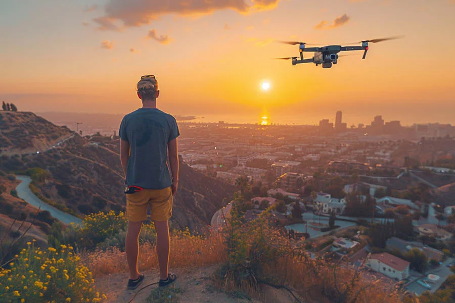
Photographers have always searched for new viewpoints, climbing towers and hills to see familiar scenes differently. Drones have made those elevated perspectives accessible to almost anyone with patience and curiosity. Aerial photography reveals shapes, textures, and patterns that remain invisible from the ground. Rivers become ribbons, fields turn into abstract grids, and crowds form living mosaics. Capturing those images well requires more than simply flying high and pressing a button. Light, composition, and timing matter as much in the sky as on the ground. This article shares practical lessons for creating compelling images from above. It references a folding drone with a Hasselblad camera and 1-inch sensor, identified in the listing as the Mavic 2 Pro. Legal reminders for US pilots appear along the way. Let us look at the world from a new angle.
Aerial Photography Starts with Light
Light shapes every photograph, and its direction matters even more from above. Low morning and evening sun creates long shadows that reveal texture across terrain. Midday light flattens scenes, though it works well for vivid water and tropical beaches. Great landscape photography from the air often happens during the golden hours after sunrise and before sunset. Overcast days soften contrast, suiting forests, waterfalls, and moody coastlines. Blue hour after sunset adds rich color, and the 1-inch sensor here handles low light gracefully. Some photographers finish a twilight flight, then spend the evening watching stars from a comfortable shelter. Check sun position apps to plan where shadows will fall. Weather forecasts help predict fog, clouds, and dramatic skies. Planning around light separates snapshots from art.
Composing from Above
Top-down shots flatten scenes into graphic patterns that feel almost abstract. Look for strong lines such as roads, rivers, crop rows, and shorelines. Repetition creates rhythm, whether in parked boats, beach umbrellas, or orchard trees. Contrast between colors, such as turquoise water against pale sand, draws the eye instantly. Aerial photography also rewards leading lines that guide viewers through the frame. Include a small human element occasionally to communicate scale. Tilted camera angles add depth, showing horizons and layered landscapes. Use the grid overlay to balance compositions and keep horizons level. Experiment with altitude, since a few meters change the entire composition. Fresh perspectives come from deliberate exploration.
Aerial Photography for Property Listings
Real estate marketing has embraced elevated imagery because buyers want context. Professional real estate photography uses aerial shots to show lot size, neighborhoods, and nearby amenities. Fly at moderate heights, often between fifty and one hundred fifty feet, for natural perspectives. Capture the front, back, and corners of the property in soft, even light. A 1-inch sensor keeps detail crisp in rooftops, landscaping, and driveways. HDR modes help balance bright skies with shaded facades. Commercial work requires a Part 107 remote pilot certificate in the United States. Registration with the FAA and active Remote ID are also mandatory for this model. Always inform neighbors and respect their privacy during shoots. Professional results build trust with clients.
Wide Views and Moving Time
Some scenes are simply too large for a single frame. An aerial panorama stitches multiple images into sweeping views of mountains, coastlines, or skylines. This model includes several panorama modes that capture and merge frames automatically. Spherical panoramas create immersive images viewers can explore by dragging around. Vertical panoramas suit tall subjects such as waterfalls or towers. Shoot in consistent light to avoid visible seams between frames. Hover steadily and let the drone complete the sequence without interruption. RAW files give extra flexibility when blending exposures in editing software. Panoramas often become the most shared images from a trip. Scale tells stories single frames cannot.
Aerial Photography in Motion
Motion adds another creative dimension to elevated imagery. A drone hyperlapse compresses minutes into seconds while the aircraft moves along a path. Clouds race, traffic flows, and shadows sweep dramatically across landscapes. This model offers built-in hyperlapse modes, including circle, course lock, and waypoint options. Timelapses from a hovering position show tides, sunsets, and city lights changing. Choose subjects with visible movement, such as busy streets or drifting clouds. Calm wind conditions produce smoother results with fewer stabilization artifacts. Battery life matters, since longer sequences need generous flight time. Up to 31 minutes per battery supports ambitious hyperlapse projects. Time itself becomes your subject.
Building Your Aerial Photography Kit
Start with a drone that offers a large sensor, stable gimbal, and reliable transmission. This model combines a Hasselblad camera, 1-inch CMOS sensor, OcuSync 2.0, and omnidirectional obstacle sensing. Add spare batteries, since good light rarely lasts long. ND filters control exposure in bright conditions and enable smoother video motion. A sturdy case protects the aircraft during hikes and travel. Editing software turns RAW files into finished images. Register with the FAA, complete the TRUST test or Part 107, and enable Remote ID before flying. Older models may have limited accessories, so confirm availability early. To review the full specifications, explore the product page before building your kit. The best viewpoints are waiting overhead.